Officially Launched in 2012, info-maps was an entrepreneurial endeavor between myself and business partner/friend/engineer, James Sweeney. Our customers included the GoPro Mountain Games, the 2015 World Championships, Rocky Mountain Adventure Rentals and many more. We also ran our own websites dedicated to camping locations, river trips, mountain bike trails, and more. During our time in business, we had produced multiple mobile-first, digital mapping applications and hundreds of printed maps for events, activity providers, and travel publications across the state.
info-maps
Title: Co-founder
Role(s):
Product Management
UX & Product Design
Cartography
Sales
The ProblemProblem
James and I had been working together in the digital publishing business for quite a few years. And back in 2010, when the iPhones were becoming the standard, we noticed that more and more people were walking around Vail Village just staring at their phones. Often times, they were looking at PDF maps of the village trying to figure out where the nearest bar was – pinching the screen, zooming in, only to have the app crash. And most of the time, they were looking at the the tourism and activity maps that I had produced years prior for Orographic Publishing.
After speaking with several concierge in vail village, it was apparent that the world had changed. People no longer wanted printed brochures or printed maps, they wanted everything on their phones. And at the time, there really were not any digital mapping solutions that were mobile friendly. So James and I set out to solve that problem.
The SolutionSolution
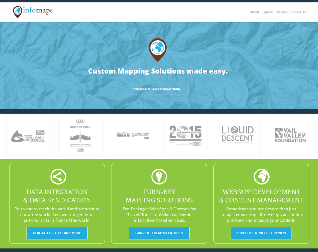
Image: Info-maps Map Theme for WordPress.
Before we started designing and developing, we first wanted to understand who our potential customers were and whether or not there was a reachable market. Tourism and Activity Guides, Local Event Companies, Rental and Tour Operators were all at the top of our list. And it only took a few weeks of interviews and cold calls to realized that we did in fact have a market.
Over the course of 5 years, we built what I believe to be the worlds first, fully integrated and mobile-first mapping platform for WordPress. We started by building a series of mobile-first wordpress themes that customers could activate as their own website. We eventually released a plugin that allowed any site to use Google Earth as their own personal mapping platform. And towards the end, we began offering data feeds through info-maps APIs. The genius of the platform was that we turned every data point on a map into a page of content for the host site. For SEO, the infomaps platform was well ahead of its time and helped to launch multiple businesses for our customers.
0
Years in Business
+0
Websites Launched
+0
Event & Activity Maps Created
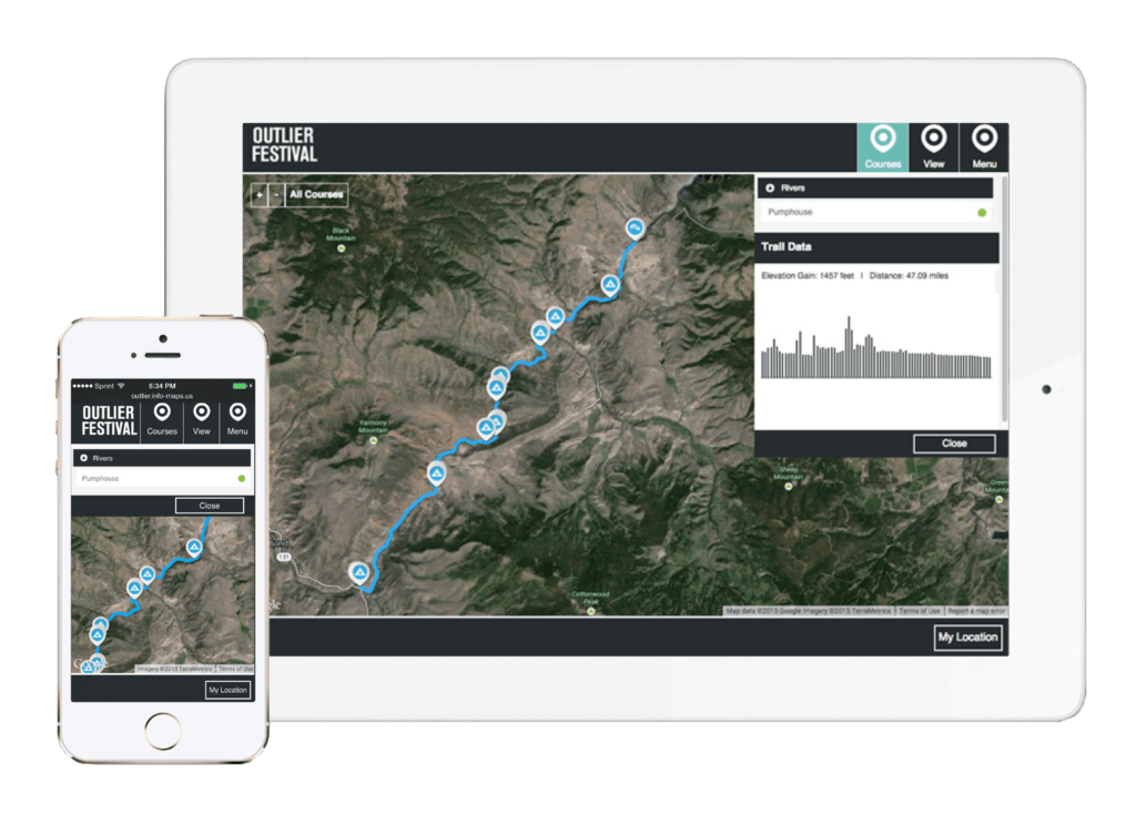
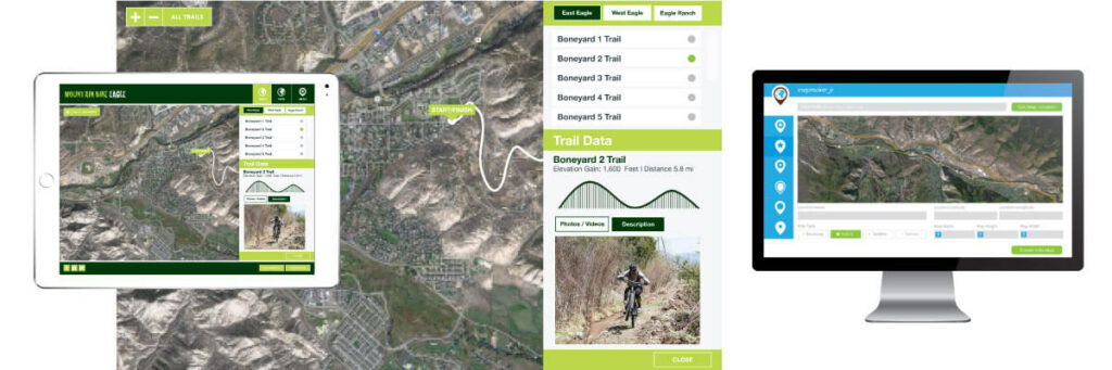
Image: Interactive Mountain Bike Map on Customer Site using the info-maps WordPress map builder plugin.
challenges & lessons learnedchallenges
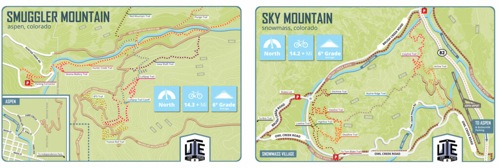
Image: mountain bike trail maps printed on waterproof and tear resistant cards for Ute City Cycles in Aspen, Colorado
Even though we were making sales and bringing in customers, we were never able to reach scale. We did not have the funding nor the guts to hire the team needed to keep up with how quickly technology was moving and catching up to us. We eventually closed simply because neither of us were in a position to risk our futures with expensive loans.
In the end, the mistake we made was trying to build a business focused on acquiring new customers. What we should have been focused on was building our own mapping destination product – a single website that we owned and controlled – the model that worked for all who came after us. Too much time and energy had been wasted chasing sales.
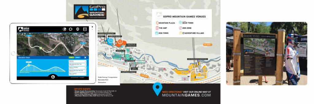
Image: Infomaps was the official map provider (digital & print) for the GoPro Mountain Games from 2010-2015
retro & new beginningsretro
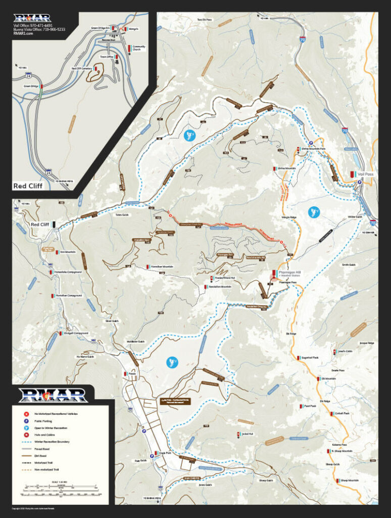
Image: Vail Pass Backcountry Ski and Snowmobile Map for Rocky Mountain Adventure Rentals.
Closing infomaps has been the biggest regret of my career. We were on to something well ahead of the market. We were first to market with a digital cannabis map and years later, weedmaps hit the market. We were first to market with a camping location website and years later, sites like TheDyrt and others came into existence. We were first to market with a data feed api and years later, sites like ToGo and RoadTrippers came to market. We were on the right path, but we flinched.
In 2021, James and I have regrouped and have since launched newDescents with the hope of building what we should have built years ago.